One river carries four different names before it reaches the sea. This article covers the Brahmaputra, from its Tibetan source to a live dam dispute with China.


✊ Must Know
Course: Tibet to Bangladesh
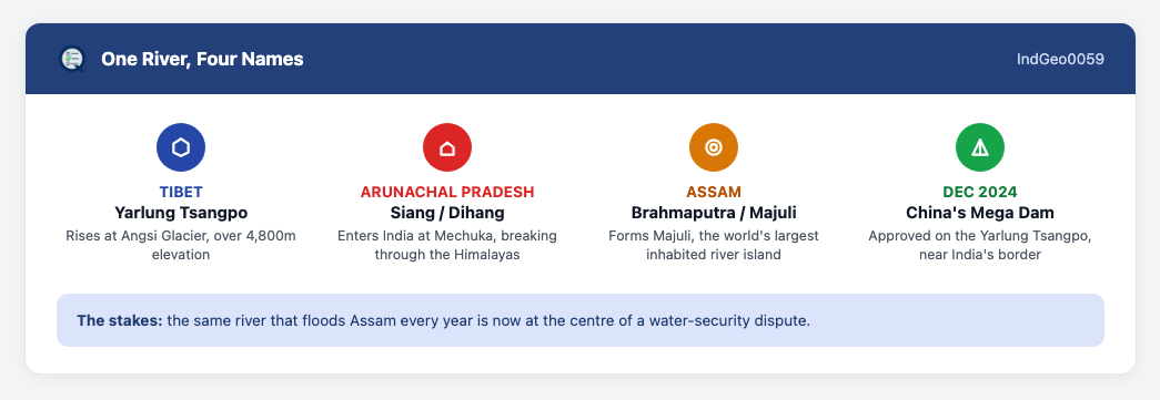
- The Brahmaputra rises at the Angsi Glacier in Tibet, at over 4,800 metres elevation. There, it is called the Yarlung Tsangpo.
- It enters India in Arunachal Pradesh, near Mechuka, where it is known as the Siang or Dihang.
- The river becomes the Brahmaputra once it reaches Assam. It later enters Bangladesh, where it is called the Jamuna.
- The Brahmaputra is a classic braided river. It splits into multiple shifting channels, forming and reforming sandbars continuously.
- It creates Majuli, the world’s largest inhabited river island, in Assam. The island keeps shrinking as the river’s channels shift.
📘 Good to Know
Floods and the New Mega-Dam Race
- The Brahmaputra floods heavily most years in Assam. Heavy monsoon rain and a huge silt load, carried down from the Himalayas, both drive this recurring flooding.
- China approved the world’s largest hydropower dam on the Yarlung Tsangpo in December 2024. Its planned capacity would triple China’s existing Three Gorges Dam.
- India has responded with its own hydropower push, planning over 200 dams across the northeast, mainly in Arunachal Pradesh, targeting roughly 75 gigawatts of capacity.
- Without a water-sharing treaty between India and China, the dam raises real concerns about “hydro-leverage,” control over downstream flow during droughts or floods.
Test Yourself

🌟 Great to Know
Borders, Braiding, and a Seismic Risk
- A single river carrying four names across three countries shows how political borders cut across natural geography. The river itself doesn’t change; only what people call it does.
- The Brahmaputra’s braided nature, unlike the more single-channelled Ganga in its middle course, reflects the steep gradient and huge sediment load it carries down from the Himalayas.
- China’s mega-dam sits near a seismically active zone, close to where the world’s strongest recorded land earthquake occurred. That combination of scale and location amplifies the project’s real risk.
- India’s matching dam-building push in Arunachal Pradesh mirrors China’s project directly, turning a shared river into a genuine strategic competition, not just an engineering one.
📝 Previous Year Questions
Which Rivers Feed the Brahmaputra?
- All three Dibang, Kameng, and Lohit are all real tributaries of the Brahmaputra.
- Left vs right bank The Lohit and Dibang join the Siang about 30 km downstream of Pasighat to form the Brahmaputra. Kameng joins later, as a right-bank tributary in Assam.
- Answer: (d) 1, 2 and 3.
- View this question on the full 2016 paper →
Leave a Reply