A cloud can hold its rain back for longer than seems possible, and then let go of all of it at once — a phenomenon that has repeatedly turned Himalayan valleys into disaster zones within minutes.

 MCQ Questions
✅ Must Know
What a cloudburst is
- A cloudburst is an extremely intense burst of rainfall over a small area, in a very short time. The India Meteorological Department generally defines it as about 10 cm of rain in an hour.
How it forms
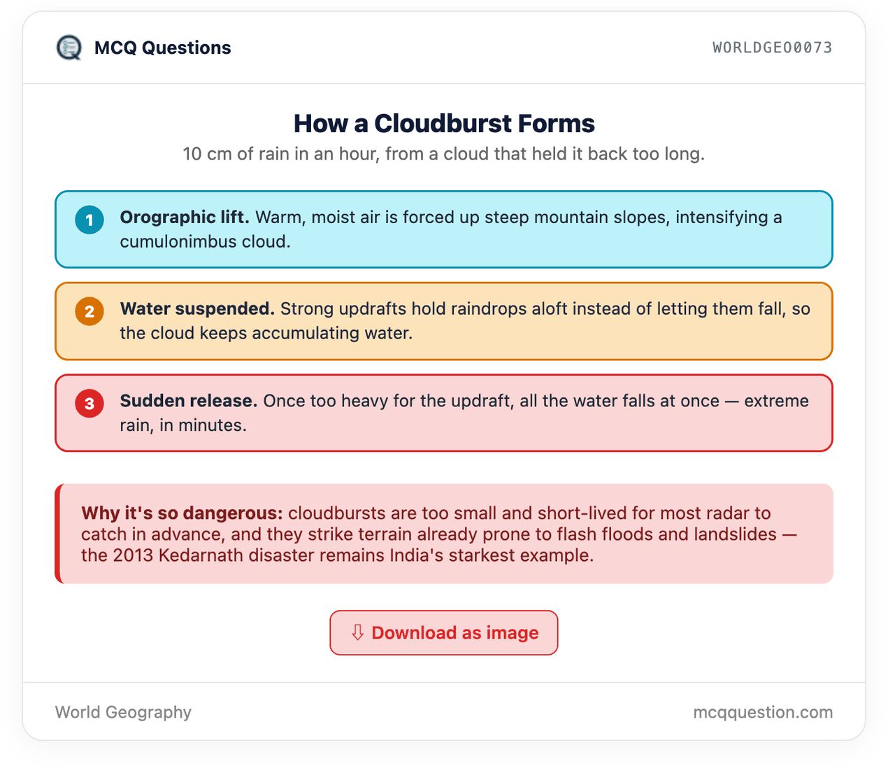
- A cloudburst forms inside a towering cumulonimbus cloud. Strong updrafts hold raindrops suspended in the air instead of letting them fall gradually.
Why the release is so sudden
- As suspended water keeps accumulating, it eventually grows too heavy for the updraft to support. All of it releases at once, producing a short, extremely intense burst of rain.
Where cloudbursts commonly occur
- Cloudbursts are especially common in mountainous terrain like the Himalaya. Warm, moist air is forced to rise sharply against steep slopes, a process called orographic lift. This intensifies the storm.
💡 Good to Know
A genuinely localized event
- Cloudbursts are extremely localized, often affecting just a few square kilometres. They are also extremely short, usually lasting under an hour. This makes them a distinct, microscale weather event, not just intense heavy rain.
Consequence: flash floods
- So much rain falls in so little time that cloudbursts routinely trigger sudden flash floods below. People downstream often get almost no warning at all.
Consequence: landslides and debris flows
- In steep mountain terrain, sudden runoff from a cloudburst can trigger landslides and debris flows. This adds a second hazard on top of the flooding itself.
A well-known Indian example
- The 2013 Kedarnath disaster in Uttarakhand was triggered by intense rainfall and cloudburst-like conditions. It caused catastrophic flash floods and landslides, among India’s deadliest such events in recent decades.
Test Yourself


🌟 Great to Know
Why forecasting them is so hard
- A cloudburst’s small size and short duration put it below the resolution of most weather radar and forecast models. This is especially true in remote mountainous terrain with sparse monitoring stations. That’s why cloudbursts often strike with little advance warning.
A possible climate change link
- A warmer atmosphere can hold more moisture, roughly 7% more per degree Celsius of warming. This is a plausible mechanism for more frequent or intense cloudburst-type events. But attributing any single cloudburst to climate change remains scientifically difficult, given how localized they are.
Why mountain regions face compounding risk
- Steep terrain, unstable slopes, and dense settlement along river valleys all raise the stakes. A cloudburst in the Himalaya can cause damage far beyond what the same rainfall would cause on flatter ground.
The forecasting gap as a policy problem
- Because cloudbursts resist advance prediction, disaster management in cloudburst-prone regions leans on other tools instead. Dense local monitoring networks, early-warning sirens, and pre-identified evacuation routes matter more here than reliable advance forecasts.
📝 Previous Year Questions
UPSC Mains 2024 GS Paper I, Q6
Beyond the answer
Browse all world-geography topics →
📚 Keep reading
SciTech0150 — Cloud Seeding: How Artificial Rain Is Used to Fight Air PollutionUPSC CSM 2022 — General Studies Paper III (Full Question Paper)UPSC CSP 2019 — General Studies Paper I (Full Question Paper)EnvEco0197 – Acid Rain: Which Gases Actually Cause ItUPSC CSM 2024 — General Studies Paper I (Full Question Paper)❓ Practice this topic
D0095 — Where and when are small tornadoes most often reported in India?D0094 — Which statement correctly distinguishes a tornado from a tropical cyclone?D0093 — Why do the majority of the world's tornadoes form around the Gulf of Mexico?D0092 — On what basis does the Enhanced Fujita (EF) scale rate the intensity of a tornado?🎲 Take a World Geography Quiz
Leave a Reply