A gorge is the same width top to bottom. A canyon is wider at the top. That one distinction is a favourite exam trap.
This article covers river, karst, glacial, coastal and desert landforms, and how each evolves over time.

🏛️ Must Know
River Valley Evolution: Youth to Old Age
- YouthYoung rivers flow fast over steep, original slopes, so downward cutting dominates over sideways erosion. This carves shallow V-shaped valleys with almost no floodplain. Waterfalls appear wherever the river meets a patch of harder rock it has not worn down yet.
- MatureAs gradients ease, downward cutting slows and the river starts eroding its banks sideways instead. Valleys stay V-shaped but grow deeper, tributaries multiply, and earlier waterfalls get worn away as the main channel widens into a real floodplain.
- Old AgeBy this stage the gradient is so gentle that the river has almost stopped cutting downward at all. It wanders freely across a vast floodplain instead, building natural levees and oxbow lakes as the whole landscape settles close to sea level.
- PeneplainGiven enough time, this cycle can wear an entire highland down to a gently rolling near-plain called a peneplain. A few unusually hard rock masses resist even this final flattening and stand out as isolated hills called monadnocks.
Erosional River Landforms
- Gorge vs CanyonBoth are deep valleys with very steep sides, but the rock they cut through decides their shape. Hard, uniform rock erodes evenly into a gorge of equal width top to bottom. Horizontally bedded sedimentary rock instead erodes unevenly into a step-sided canyon, wider at the top. Andhra Pradesh’s Gandikota Canyon, carved by the Pennar river, is a real example.
- Potholes and Plunge PoolsPebbles trapped in a small dip on a hill-stream’s rocky bed get spun by the current. This grinds the dip into a deeper, rounder pothole over time. At the foot of a waterfall, the same grinding action on a much larger scale carves out a deep plunge pool.
- Incised MeandersMeanders usually form only where a river winds lazily across a flat floodplain. If the land beneath is later uplifted, the river keeps cutting straight down along its old winding path. It does not straighten out, so deep meanders end up entrenched in solid rock.
- River TerracesWhen a river’s base level drops, it starts cutting a new, lower channel into its own old floodplain. A strip of the former floodplain is left stranded above as a terrace. Terraces at matching heights on both banks are called paired terraces.
Depositional River Landforms
- Alluvial FansA fast mountain stream can carry heavy, coarse debris as long as its slope stays steep. The moment it breaks onto a gentler plain, it suddenly loses the power to carry that load, and dumps it in a spreading, cone-shaped fan.
- DeltasA delta forms the same basic way as an alluvial fan: a river dumping its load once it slows down. Here that happens at the coast instead of a mountain foot. The calmer water there sorts the sediment far more neatly into distinct layers, and the river splits into growing distributary channels as it builds outward.
- Natural Levees and Point BarsWhen a river floods over its banks, the heaviest sediment settles out first, right at the bank. This slowly builds a raised ridge called a natural levee. Inside a meander bend, slower water on the inner curve deposits sediment as a point bar, also called a meander bar.
- Oxbow LakesA meander loop grows tighter over time as the river erodes its outer bank and deposits on its inner bank. Eventually the loop’s neck narrows so much that the river cuts straight across it, stranding the old loop as a curved, standalone oxbow lake.
📘 Good to Know
Karst Topography: Erosional Forms
- Named for a RegionLimestone and dolomite dissolve slowly in mildly acidic rainwater and groundwater, unlike most other rocks, which mainly just get worn down mechanically. This chemical dissolving process carves the distinctive terrain named after the Karst region of the Balkans, where it was first studied.
- SinkholesWater dissolves limestone fastest wherever it can pool or funnel underground, so a small surface depression steadily deepens into a circular, funnel-shaped sinkhole. Some form this way directly; others open up when the roof of an underground cave finally collapses. Either way, sinkholes are by far the most common topographic form in karst terrain.
- Lapies and Valley SinksWater dissolves rock fastest along natural cracks called joints, leaving the harder rock between them standing up as irregular ridges called lapies. When enough neighbouring sinkholes dissolve into each other and merge, they form a long trench called a valley sink, or uvala.
- PoljeThis merging process can run its course over a large enough area and long enough time. The result is a polje, a large flat-floored depression and the biggest of all karst landforms.(General Knowledge)
Karst Topography: Depositional Forms
- StalactitesWater seeping through a cave roof carries dissolved calcium carbonate with it. As each drop evaporates or loses carbon dioxide, it leaves a tiny mineral trace behind. Countless drops in the same spot slowly build an icicle-shaped stalactite hanging from the ceiling.
- StalagmitesThe same mineral-laden water that builds a stalactite above eventually drips onto the cave floor below. There, the leftover calcium carbonate builds a matching mound upward instead of downward, called a stalagmite.
- PillarsGiven enough time, a stalactite growing down and a stalagmite growing up beneath it eventually meet in the middle. Once fused, they form a single solid column or pillar running floor to ceiling.

Glacial Erosional Landforms
- CirqueA glacier forming high on a mountainside plucks and grinds away at the rock beneath and around it as it slowly moves. This carves out a deep, steep-walled basin at the valley’s head, called a cirque. It often fills with a tarn lake once the ice eventually melts away.
- Horn and AreteEach cirque eats backward into the mountain as its glacier grinds away. Where three or more cirques on different sides of a peak erode toward each other, they can leave only a sharp horn standing between them. Just two neighbouring cirques instead leave a jagged, knife-edge ridge called an arete. Everest and the Matterhorn are both horns.
- FjordsA large valley glacier can carve its trough well below sea level before retreating. When the sea later floods that deep trough at high latitudes, the result is a fjord. It is prized for scenery precisely because of its steep, glacier-carved walls.

Glacial Depositional Landforms
- MorainesA glacier carries huge amounts of rock debris along as it moves, then simply dumps it wherever the ice itself stops or melts. Debris left at the glacier’s farthest point forms a terminal moraine, and debris along its sides forms lateral moraines. Where two glaciers merge, their lateral moraines combine into a single medial moraine down the centre.
- EskersAs a glacier melts, streams of meltwater often flow through tunnels within or beneath the ice itself, carrying coarse sand and gravel. When the surrounding ice finally melts away, the streambed’s own sediment is left standing as a long, winding esker ridge.
- DrumlinsA moving ice sheet can mould the loose till beneath it into a smooth, streamlined ridge shaped by the direction of flow. It is blunt and steep on the side the ice pushed from, tapering gently on the far side. This oval mound is a drumlin, and its orientation tells geographers which way the ice once moved.
🌟 Great to Know
Coastal Landforms: Two Coast Types
- High Rocky CoastsWhere the land is sinking relative to sea level, waves keep attacking the same hillside over and over instead of a shifting shoreline. This concentrated pounding erodes sea cliffs, wave-cut platforms, sea caves and sea stacks. India’s west coast is a real example.
- Low Sedimentary CoastsWhere the land is rising relative to sea level instead, gently sloping sediment has room to pile up rather than being cut away. This favours deposition: beaches, bars, barrier bars, spits and lagoons. India’s east coast is a real example.
- Spits and LagoonsLongshore currents keep pushing sand along the coast until it builds a bar reaching out from a headland, called a spit. If spits from both sides grow far enough to seal off a bay’s mouth, the trapped water behind becomes a lagoon. It then slowly fills with sediment into a coastal plain.
Desert Landforms: Pediments to Playas
- PedimentsIn deserts, a mountain front does not wear down evenly the way a humid landscape does. Instead, occasional torrential rain and sheet floods erode the mountain’s steep face while leaving its own slope angle roughly unchanged. This process, called parallel retreat of slopes, carves a gently sloping rocky pediment, also called a peripediment, at its foot.
- Inselbergs and PediplainsThe pediment grows backward by eating into the mountain rather than lowering it in place. So the mountain shrinks over time while the pediment spreads. Only unusually resistant rock survives as an isolated inselberg standing on the eventual low, featureless pediplain.
- PlayasDesert basins drain inward rather than out to sea. Any rare heavy rain collects at the centre as a shallow playa lake instead of flowing away. Once that water evaporates, it leaves behind the dissolved salts as a crusted alkali flat.
Exam Point of View
Five Types of Sand Dunes
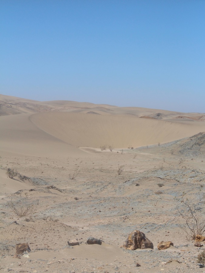
- BarchanSteady, moderate wind blowing over a flat, sandy surface pushes sand up the dune’s gentle windward slope and drops it just past the crest. This builds a crescent shape with its two points, or horns, trailing downwind.
- ParabolicPatches of vegetation anchor the dune’s tips in place while its unanchored centre keeps migrating with the wind. This drags the horns backward relative to the centre, producing a shape that is essentially a barchan turned inside out.
- Seif, Longitudinal, TransverseWhen wind direction shifts partway through a barchan’s formation, one horn keeps growing while the other stalls, leaving a single-winged seif dune. Where sand is scarce but wind direction stays constant, dunes stretch out into long, low longitudinal ridges instead of crescents. Where sand is plentiful, dunes instead line up in ridges running perpendicular to the wind, called transverse dunes.
Exam Wisdom: Named Landform Traps
- UPSC CSP 2022Asked: “Gandikota canyon of South India was created by which one of the following rivers?” The answer is the Pennar. See Q24 on the full UPSC CSP 2022 paper →
- UPSC CSM 2023Asked: “How are the fjords formed? Why do they constitute some of the most picturesque areas of the world?” See Q6 on the full UPSC CSM 2023 paper →
- CAPF (ACs) 2020Asked which karst landform is the largest in size. The answer is the polje. See Q68 on the full CAPF (ACs) 2020 paper →
- CAPF (ACs) 2021Asked which feature forms when an old meander is closed off by deposition. The answer is the oxbow lake. See Q39 on the full CAPF (ACs) 2021 paper →
- UPSC CDS (I) 2018Tested the statement that the sinkhole is by far the most common topographic form in a karst terrain. See Q12 on the full UPSC CDS (I) 2018 paper →
- Watch ForGorge and canyon, stalactite and stalagmite, and barchan and seif are frequently confused pairs. Learn the one distinguishing feature for each pair, not just the general shape.
✅ Test Yourself



Beyond the answer
Browse all world-geography topics →
📚 Keep reading
WorldGeo0001 — Geomorphology: Earth's Structure and LandformsWorldGeo0064 — Types of Rocks: Igneous, Sedimentary, and MetamorphicNDA & NA (I) 2026 — General Ability Test (Full Question Paper)CDS (II) 2022 — General Knowledge (Full Question Paper)WorldGeo0078 — Inside the Earth: Crust, Mantle, Core and the Rocks❓ Practice this topic
D4389 — A large, heavily mechanised American farm and a small Indian smallholding growing the same kind of crop are best understood as what?D4388 — Jute was historically nicknamed which of these?D4387 — Which country remains the world's largest coffee producer by a wide margin?D4386 — Cotton cultivation needs roughly how many frost-free days, along with bright sunshine, to grow well?🎲 Take a World Geography Quiz
Leave a Reply